
Simrad GO9
4.4Editor score
C-MAP Discover card included
HDI sonar transducer support
Wi-Fi and NMEA 2000
Smartphone and tablet mirroring
Marine GPS units combine navigation, charting, and often sonar into a central command center for a boat. The right model depends on your vessel, waters, electronics, and navigation habits, making screen size, mapping options, connectivity, and installation requirements especially important.
This guide compares ten fixed-mount chartplotters and rugged handhelds using the supplied product details, including supported sonar, preloaded mapping, display characteristics, networking, and waterproofing. It covers practical options for coastal fishing, cruising, offshore navigation, and smaller boats.
Each review explains the product's strongest qualities, limitations, and likely buyer. The three leading choices are highlighted at the top, while every product receives a detailed breakdown. Prices and availability can change, so confirm current listings before purchasing.
4.4Editor score

4.7Editor score

As an Amazon Associate we earn from qualifying purchases.
The comparison covers fixed-mount multifunction displays, chartplotters with sonar, mapping displays, and portable marine GPS handhelds. Screen size, chart coverage, sonar support, network connections, and water resistance reveal which option best fits a particular boat and navigation style.


The Simrad GO9 is a versatile multifunction display for sportboats, center-consoles, and smaller cruisers. Its 4.4 rating reflects a capable overall package that combines GPS navigation, sonar support, radar capability, C-MAP Discover mapping, and network connectivity in one unit.
We may earn a commission when you buy through this link, at no additional cost to you.
The included C-MAP Discover card is a major attraction for buyers who want detailed vector charts, custom depth shading, tides and currents, bathymetric contours, and broad United States and Canadian coverage. The supplied 83/200 kHz HDI transducer supports CHIRP sonar and DownScan Imaging, helping users interpret bottom structure and locate fish-holding areas.
Built-in GPS, Wi-Fi, and NMEA 2000 support make the GO9 useful for a growing marine system rather than an isolated chartplotter. It can mirror its display to a phone or tablet, and the product description indicates that radar and other functions can also be accessed from those devices. The trade-off is that buyers should verify compatibility with their existing electronics before committing.
This is a strong choice for a new or upgraded boat that needs charting and sonar in one reasonably focused package. It particularly appeals to Simrad users who want a connected command center, though boaters with an established Garmin ecosystem may find the Garmin alternatives easier to integrate.
C-MAP Discover adds useful depth, tide, current, and contour information without requiring a separate chart purchase at the outset. That makes the GO9 a practical all-in-one option for boaters building a capable helm from a relatively compact electronics platform.
HDI sonar support gives the display a useful starting point for locating structure and fish, while NMEA 2000 and Wi-Fi create options for connecting instruments and mobile devices. The result is a flexible foundation for a modern marine electronics setup.
We may earn a commission when you buy through this link, at no additional cost to you.
The Garmin ECHOMAP UHD2 94sv is a balanced fixed-mount chartplotter and fish finder with a strong 4.7 rating. Its nine-inch touchscreen combines clear sunlight visibility with Garmin traditional, ClearVü, and SideVü scanning sonar, making it a strong all-around unit for modern recreational boats.
We may earn a commission when you buy through this link, at no additional cost to you.
The included GT56-TM transducer is one of the package's most important components. It supports three distinct sonar views, helping anglers inspect fish, structure, and the sides of the boat. Built-in Garmin Navionics+ coastal charts provide useful mapping from the outset, while wireless sharing allows waypoints and routes to move between compatible ECHOMAP UHD2 displays.
Wi-Fi connectivity also extends to compatible Force trolling motors. Users can follow routes, navigate to waypoints, check battery life, and control motor speed without relying on separate controls at the console. This integration is especially valuable on fishing boats, although a larger screen and complete transducer package require more helm space than a compact handheld.
The ECHOMAP UHD2 94sv is best for anglers and cruisers seeking a capable, ready-to-install helm with modern sonar and motor integration. It is a particularly persuasive choice when a boat does not yet have a chartplotter, while owners of an extensive Garmin network should confirm compatibility and expansion options before installing it.
Traditional, ClearVü, and SideVü sonar give the unit multiple ways to examine underwater conditions. A broad transom-mounted transducer and side-scan coverage can help anglers locate drop-offs, vegetation, structure, and fish.
Wireless Force trolling motor control is the feature that extends the ECHOMAP beyond basic mapping. Route following, waypoint navigation, speed adjustment, and battery monitoring make the display a central helm interface.
We may earn a commission when you buy through this link, at no additional cost to you.
The Garmin GPSMAP 943xsv SideVü is a high-performance marine GPS display with a 4.7 rating. Its key attractions are ultra high-definition scanning sonar, Panoptix sonar support, preloaded mapping, and improved display optics for a polished high-end navigation experience.
We may earn a commission when you buy through this link, at no additional cost to you.
The strongest case for this model is its combination of charting and advanced sonar visualization. Panoptix support can provide a more immersive view of the underwater environment, while the improved optics are intended to make important information easier to interpret. Preloaded mapping reduces the need to begin with a basic chart-only installation.
Advanced features do not guarantee that the product is ready for every boat without additional planning. Buyers may need compatible transducers, mounting hardware, wiring, power, and potentially other network equipment. The listing is also presented by part number, so confirming the exact configuration and included accessories is important.
The GPSMAP 943xsv is suited to anglers and boaters who value sophisticated sonar more than a basic chartplotter. Choose it when you understand its ecosystem and can integrate the necessary components; otherwise, the ECHOMAP UHD2 94sv may offer a more straightforward package.
Ultra HD scanning sonar and Panoptix support target buyers who want detailed underwater imagery. These capabilities are most valuable when paired with compatible equipment and used by an angler who understands how to interpret different sonar returns.
Improved display optics support the unit's high-end positioning. A clear screen can make route review, waypoint management, and sonar interpretation more comfortable, especially on a busy helm where information must be recognized quickly.
We may earn a commission when you buy through this link, at no additional cost to you.
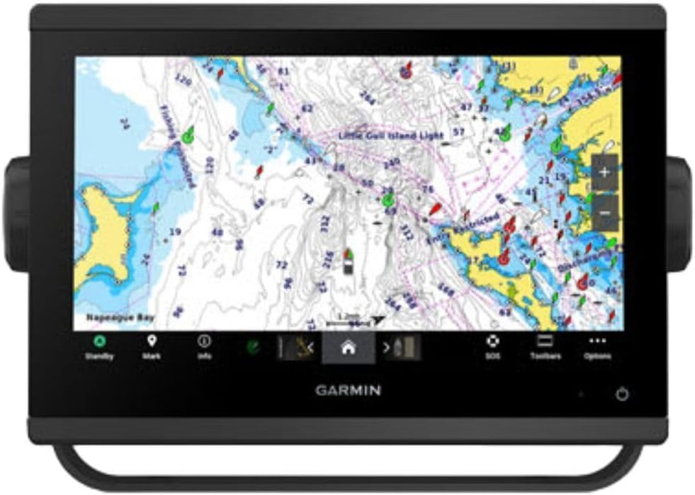
The Garmin GPSMAP 1243xsv with GMR 18 HD3 Radome is a large, fully connected helm option. It is built around a 12.3-inch class display, preloaded Garmin Navionics+ charts, broad network connectivity, and an included radar radome for enhanced awareness.
We may earn a commission when you buy through this link, at no additional cost to you.
The GMR 18 HD3 radome is the major system-level feature. Radar is particularly useful when visibility is reduced by darkness, fog, rain, or coastal terrain, making the package a stronger candidate for offshore cruisers, larger fishing boats, and multi-electronics builds than a simple mapping display.
OneHelm digital switching support allows compatible third-party devices to join the marine system, while network connectivity is positioned as the foundation for a broader helm architecture. A 12-inch-class unit also provides room for charts, sonar, radar, engine data, and other information, but it demands adequate console space and careful mounting.
This is a compelling premium recommendation for a boat with room for a large display and a broader navigation system. Since the supplied listing does not provide a numeric rating, prospective buyers should evaluate current customer feedback and confirm the full contents of the package before buying.
The included GMR 18 HD3 Radome adds a major layer beyond cartography and wayfinding. It helps a skipper monitor surrounding traffic and hazards when conditions make visual observation less reliable.
OneHelm and network connectivity make this display better suited to vessels with compatible instruments, engines, and switching systems. The broader the onboard electronics plan, the more useful a centralized marine network can become.
We may earn a commission when you buy through this link, at no additional cost to you.
The Garmin GPSMAP 79sc is a rugged, floating handheld GPS with a 4.0 rating. It is designed for marine use and includes preloaded BlueChart g3 coastal charts, making it a practical backup or primary navigation device for anglers, kayakers, and small-boat operators.
We may earn a commission when you buy through this link, at no additional cost to you.
Its standout physical feature is the ability to float. The unit has an IPX6 water-resistance rating at the unit level, and its scratch-resistant, fogproof glass is designed for demanding outdoor use. The high-resolution color display provides a clear mapping interface even though the screen is naturally smaller than a fixed chartplotter's.
Storage and tracking are generous for a handheld, with room for 10,000 waypoints, 250 routes, and 300 fitness activities. Support for GPS, GLONASS, Beidou, Galileo, QZSS, and SBAS improves positioning options, while the built-in three-axis compass shows heading when stationary.
The 79sc is ideal for a portable backup, a small craft without a fixed console, or a skipper who wants a separate coastal navigation device. It cannot provide the sonar or large-screen convenience of a multifunction display, and its IPX6 designation should not be interpreted as permission for unrestricted submersion.
A floating body can save a handheld after a deck slip or unexpected launch into the water. Combined with rugged glass and fogproof construction, that resilience makes the GPSMAP 79sc well suited to active outdoor boating.
Preloaded BlueChart g3 coastal charts remove the need to begin with a blank basemap. The chart is particularly useful for anglers, paddlers, and small craft operating close to shore.
We may earn a commission when you buy through this link, at no additional cost to you.
The Garmin GPSMAP 79s is a floating marine handheld with a worldwide basemap and a 4.2 rating. It offers a durable, chart-free starting point for travelers who need general marine mapping across multiple countries rather than a fixed chartplotter at the helm.
We may earn a commission when you buy through this link, at no additional cost to you.
Its rugged construction includes a high-resolution color display, scratch-resistant and fogproof glass, and IPX6 water resistance at the unit level. The floating design is especially reassuring for anglers, kayakers, and users of small boats that are frequently launched from a shoreline or carried on a deck.
The worldwide basemap provides a broad geographic foundation, while support for six satellite constellations can improve tracking reliability around the world. Storage for 10,000 waypoints, 250 routes, and 300 fitness activities is substantial, and the three-axis tilt-compensated compass maintains heading while the user is stationary.
The GPSMAP 79s is most useful for international travel, portable navigation, and backup use. Coastal anglers may prefer the GPSMAP 79sc because it includes BlueChart g3 coastal charts, while those seeking a larger interface should consider a fixed-mount model. Battery life is listed at up to 20 hours in GPS mode.
The included worldwide basemap makes this a natural companion for boating across different regions. It provides broad context for coastlines and inland waters when a more detailed regional chart package is not the priority.
Up to 20 hours in GPS mode supports full-day outings. Users should still carry backup power for extended trips, especially when cold conditions, screen use, and accessory connections can affect real-world battery performance.
We may earn a commission when you buy through this link, at no additional cost to you.
The Garmin GPSMAP 1022xsv is a 10-inch combo chartplotter with a 4.7 rating. It provides a large fixed display and a combination navigation and sonar platform, but the exact listing explicitly identifies the bundle as including no transducer.
We may earn a commission when you buy through this link, at no additional cost to you.
That distinction is essential. A combo unit can support sonar when paired with the appropriate compatible transducer, but the supplied product data does not confirm which transducer, if any, is required for the intended setup. Buyers should plan for a compatible mount and installation before assuming the system is ready to fish immediately.
The ten-inch screen gives the unit an advantage over smaller chartplotters when displaying routes, chart detail, sonar returns, and other data together. A 4.7 rating also suggests generally favorable customer reception, although the provided listing includes only a manufacturer, model description, and part number rather than a detailed feature breakdown.
The GPSMAP 1022xsv fits boaters who want a large Garmin combo unit and are comfortable sourcing the remaining installation pieces. It may serve as a better navigation centerpiece than a compact display, but the lack of an included transducer makes the ECHOMAP UHD2 94sv a more complete package for a new installation.
The ten-inch display provides a useful balance of chart detail and physical presence. It is an attractive center-console option for navigators who prefer more visible information than a compact screen can provide.
A combo designation does not mean the necessary sonar transducer is included. Confirm the exact transducer type, mounting location, wiring, and network requirements before finalizing the installation.
We may earn a commission when you buy through this link, at no additional cost to you.
The Garmin GPS 76 is a straightforward handheld GPS navigator with a 4.6 rating. Rather than competing with modern multifunction displays, it focuses on essential position tracking, waypoint navigation, and long battery life in a simple, portable form.
We may earn a commission when you buy through this link, at no additional cost to you.
Its WAAS-enabled receiver continuously tracks and can use up to 12 satellites, providing an established foundation for basic navigation. The trip computer reports current and average speed, elapsed time, and trip distance, making the unit useful for boaters, hikers, or other travelers who value straightforward statistics.
Memory is limited to 1 MB for data downloaded from optional Garmin MapSource CD-ROMs. That limitation makes the GPS 76 less attractive for detailed modern marine charting, but it also helps keep the device simple and focused. Two AA alkaline batteries provide up to 16 hours of use.
Choose the GPS 76 as a lightweight backup, a general-purpose locator, or a no-frills option for a small craft. For serious marine navigation, choose a floating modern handheld with preloaded charts or a fixed chartplotter with a much larger display and stronger integration options.
The WAAS-enabled receiver provides a straightforward way to record a position and navigate to saved points. It lacks the visual and network complexity of newer multifunction units, which can be an advantage for users who want few controls and clear status information.
Current speed, average speed, timer, and trip distance cover the most common journey statistics. These readouts are useful for short recreational trips and for monitoring progress without relying on a phone or a more complex chartplotter.
We may earn a commission when you buy through this link, at no additional cost to you.
The Garmin GPSMAP 1223xsv is a feature-rich 12-inch combo GPS and fish finder with a perfect 5.0 supplied rating. It combines a bright IPS touchscreen, built-in traditional CHIRP, ClearVü, and SideVü sonar, a worldwide basemap, and extensive networking options.
We may earn a commission when you buy through this link, at no additional cost to you.
The IPS panel is designed to remain bright, clear, and readable in varied conditions, including direct sunlight. That visibility is a major advantage on an exposed helm. Traditional 5,000-watt CHIRP sonar adds target separation and clarity, while ClearVü and SideVü provide more detailed views of fish and bottom structure.
Connectivity is comprehensive. J1939 supports compatible engines and devices, NMEA 2000 and NMEA 0183 networking can connect compatible marine electronics, and built-in Wi-Fi and Bluetooth allow interaction with a phone or tablet. Optional BlueChart g3 Vision charts and Garmin radar can extend the system further.
The GPSMAP 1223xsv is a strong fit for an offshore fishing or cruising boat with a large console and a plan for connected electronics. Its 12-inch size may be excessive for a compact vessel, and detailed charts or radar are optional, but the core combination is thorough for buyers who want one central marine display.
The 12-inch IPS panel provides enough screen area for complex routes and detailed sonar views. Improved visibility in direct sunlight makes it easier to operate from a bright cockpit without constantly adjusting the display.
J1939, NMEA 2000, NMEA 0183, Wi-Fi, and Bluetooth create broad integration options. Compatible engines, autopilots, radios, AIS transponders, and digital switching systems can become part of a more unified helm.
We may earn a commission when you buy through this link, at no additional cost to you.
The Garmin GPSMAP 743 is a compact seven-inch mapping chartplotter with a 5.0 supplied rating. Its title identifies it as a non-sonar model with preloaded Navionics+ mapping, making it a focused navigation option for boats that already have separate sonar or do not need built-in fish-finding.
We may earn a commission when you buy through this link, at no additional cost to you.
Preloaded Navionics+ mapping gives the display immediate navigational value, while improved optics support clear screen viewing. The seven-inch format is smaller than the premium 10-, 12-, and 12.3-inch-class models, making it easier to fit into more compact helm arrangements.
The supplied bullet points also mention ultra high-definition scanning sonar and Panoptix support, but the product title explicitly calls this model non-sonar. That inconsistency makes careful listing verification essential. Buyers should not assume a transducer is included or that the unit offers the same integrated sonar experience as the ECHOMAP or GPSMAP xsv combos.
The GPSMAP 743 is a strong fit for a navigation-focused boat, a center console needing a reasonably sized chartplotter, or a Garmin system centered on mapping and networking. It is less appropriate for an angler expecting a turnkey fish finder unless the seller confirms the exact hardware configuration.
Preloaded Navionics+ charts and a clear seven-inch screen concentrate the unit's value on route planning and position awareness. This makes it a practical option when sonar is supplied elsewhere on the boat.
The listing's non-sonar title and sonar-related bullet points do not fully agree. Check the manufacturer part number, package contents, and transducer status before purchase to avoid expecting features the supplied configuration may not provide.
We may earn a commission when you buy through this link, at no additional cost to you.
Choosing a marine GPS unit starts with how and where you will use it. Chart coverage, sonar needs, display size, power management, networking, and installation constraints should guide the decision more than features that will never be used.
Choose a fixed display when the unit will be the boat's main navigation command center. Choose a handheld when portability, resilience, and a low barrier to setup matter more than screen size and integration.
Prioritize detailed, current charts for your actual routes, not merely the word premium. Confirm that regional coverage and required chart upgrades are available before installation.
Buy a complete sonar package if you want a turnkey fish finder. If your boat already has sonar, select a chartplotter that can display and integrate it without duplicate equipment.
Choose the smallest screen that comfortably presents your usual charts and sonar views. Prioritize visibility and control quality over sheer size.
Build the electronics system around future needs, but verify every compatibility claim first. A network-capable display adds little if the intended instruments cannot communicate.
Radar is most valuable for offshore and all-weather operation. Ensure the selected unit, network, and antenna form a complete supported package.
For exposed use, prioritize documented water resistance and rugged construction. For fixed systems, protect every cable connection and follow installation requirements carefully.
A lower-complexity package can be the smarter purchase if it includes everything you need. A premium platform is valuable only when the boat, wiring, and accessories can support it.
Begin by confirming that the display, transducer, power connection, and any network devices are compatible with your boat. Mount the screen where it remains visible without blocking controls, and place the transducer where it can send and receive clean signals. Read the included instructions, configure chart coverage, set the correct date and time, and confirm the unit receives a reliable position before relying on it for navigation.
Organize routes and waypoints according to the way you actually travel. For networked systems, connect instruments one at a time and verify that engine data, sonar, radar, waypoints, and routes appear as expected. Test the display in bright daylight, darkness, and rain, and learn the essential menus before departure. For handhelds, check the battery contacts and carry a backup power source for long outings.
Care for the unit by rinsing away salt and dirt with fresh water, drying it gently, and keeping connectors clean and dry. Tighten mounting hardware, inspect cables for chafing, and update charts and software when appropriate. Do not expose a unit beyond its stated water-resistance rating, and store a handheld fully dry with its battery level suitable for its manufacturer's guidance.
A marine GPS primarily determines position and provides navigation. A chartplotter adds detailed maps and route or waypoint management, while a fish finder or combo unit uses sonar to show underwater features and targets. Many modern multifunction displays combine all three roles, so the best distinction depends on whether you need mapping, sonar, or both.
No. A larger screen makes it easier to view detailed charts, sonar, radar, and engine data at the same time, but it also requires more console space. A seven-inch or nine-inch unit can be ideal for many boats, while a 10-inch, 12-inch, or 12.3-inch-class display is more useful on larger or highly equipped helm systems.
Only if you want the display to function as a fish finder or show sonar from compatible transducers. Navigation and mapping features can work without one, but packages such as the ECHOMAP UHD2 94sv include a GT56-TM for integrated sonar. Some combo listings omit the transducer, and the GPSMAP 743 is specifically designated as non-sonar.
The answer depends on available space and desired features. The Simrad GO9 offers charting, sonar, radar expansion, and connectivity in a multifunction platform, while the Garmin ECHOMAP UHD2 94sv combines a nine-inch screen with an included transducer. For a very small craft, the floating GPSMAP 79sc or 79s may be more practical than a fixed display.
It can serve as the main navigation device on a small boat, but it will not provide the large screen, permanent power, extensive networking, radar integration, or all-around helm control of a fixed unit. Handhelds are also popular as backups, with the GPSMAP 79sc and 79s offering floating, water-resistant construction.
Choose detailed charts for every coastal, lake, and river area you plan to navigate. C-MAP Discover, Garmin Navionics+, BlueChart g3, and worldwide basemaps all have different strengths and regional details. Check that the supplied coverage matches your home waters and that any required premium chart upgrades can be purchased and maintained.
They are convenient for transferring routes and waypoints, connecting phones or tablets, receiving updates, and accessing compatible equipment, but they are not essential for every basic navigation setup. A boater who relies on a closed NMEA network may prioritize waterproof reliability and instrument compatibility instead.
Radar becomes increasingly important for offshore cruising, nighttime operation, fog, heavy rain, crowded waterways, and navigation around structures or other vessels. It is less essential for many small inland boats, but a compatible unit such as the GPSMAP 1223xsv can add valuable awareness. The GPSMAP 1243xsv includes a GMR 18 HD3 Radome for larger helm systems.
The Simrad GO9 stands out as the best budget-oriented multifunction choice because it combines C-MAP Discover, an HDI transducer, Wi-Fi, and NMEA 2000. The Garmin ECHOMAP UHD2 94sv is the most balanced complete package for many anglers, while the GPSMAP 1243xsv offers the strongest premium combination of a large display, radar, and network control.
Prioritize the features your boat genuinely needs rather than simply choosing the largest screen. A fixed chartplotter is ideal for a permanent helm, a floating handheld is valuable for portability and backup, and sonar or radar packages must match the intended electronics network. Chart coverage, transducer inclusion, water resistance, and installation requirements deserve as much attention as headline features.
Ratings, package contents, availability, and prices can change, so verify the current listing and manufacturer information before ordering. In particular, confirm whether a transducer is included and whether the product's exact configuration supports every planned connection. Taking those final steps will help you choose a marine GPS unit that fits your vessel, waters, and navigation style.